
Recommended Camping Places
"We Provide What You Need: Lets Go Camping"
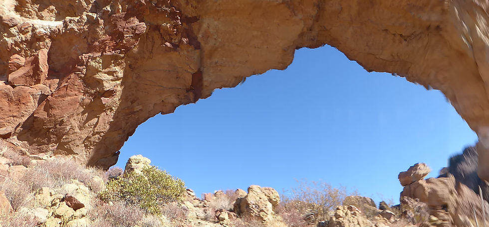
Partial Image from U.S. Geological Survey, Public domain, via Wikimedia Commons


Here are our recommended locations by season for your camping trip with AZ Places. Sites are accessible by a standard vehicle and are within 1 to 3 hours surrounding Phoenix, Arizona.
Note: Some locations have a entrance or use fee. Locations beyond 150 miles require an additional travel fee by AZ Places.
Our goal is to make going outdoors easy by providing a platform for you to create an enjoyable and memorable camping experience.
Fall
October, November, December
In the fall, Arizona offers a range of camping experiences, from near the warmer Phoenix Valley to the cooler elevations around Payson. The Payson area, with its crisp air and scenic landscapes, becomes a popular destination during this season.
When planning a camping trip in the fall, it's essential to prepare for variable weather. While daytime temperatures are often comfortable, evenings and early mornings in higher elevations can be quite chilly. Packing layers and appropriate gear ensures a comfortable and enjoyable experience.
In Phoenix, average high temperatures in September are around 98°F (37°C), decreasing to approximately 88°F (31°C) in October and 75°F (24°C) in November. In contrast, Payson experiences milder conditions, with September highs averaging 84°F (29°C), October around 74°F (23°C), and November approximately 62°F (17°C). In Flagstaff, average high temperatures in September are around 70°F (21°C), decreasing to approximately 50°F (10°C) by November. The significant temperature swings between day and night make planning and preparation key for fall camping adventures.
Additional Fee for entry and/or camping.
+ Time & Distance from Downtown


Arizona
La Paz County
69430 Wickenburg Road, Wenden, AZ 85357
34°15'51.6"N 113°33'26.6"W
2 hours 45 minutes
160 miles
We spend several nights here on the edge of the lake. Enjoyed listening to the water and the birds while siting by the fire. Really great spot for camping. Nice and secluded beaches and peninsulas with beautiful views of the lake and surrounding mountains. A lot of fishermen in boats trolling, lake is well known for bass fishing. Looking forward to return with our kayaks. While in the area we visited the Alamo Dam and made a stop for ice-cream at the ranger store at the Alamo State Park. On our drive there we saw wild burros.
Alamo Lake Wildlife Area


Arizona
Gila County
Apache Lake, Tonto National Forest, Gila County, AZ
33°37'32.4"N 111°12'11.6"W
2 hours
105 miles
Apache Lake, located in the Tonto National Forest, is a scenic reservoir offering both developed and dispersed camping options. Surrounded by steep canyon walls and accessible via the historic Apache Trail, it’s a hidden gem perfect for camping, boating, and outdoor adventures. The Burnt Corral Campground provides 76 campsites, and visitors can also enjoy secluded dispersed campsites with stunning views of the lake and desert landscape.
Apache Lake


Arizona
Coconino County
Bear Canyon Lake, AZ 85541
34°24'13.1"N 111°00'35.0"W
2 hours 30 minutes
134 miles
Bear Canyon Lake is one place we go most often. There are plenty of places to setup camp and lots to explore. We have never had a issue finding a spot to camp, at times can barely hear anyone around. We pass all the nearest sites near the lake and go past the powerlines where there are plenty of sites spread out. From there it is a bit of a hike to the lake, or short drive. Depending upon the season you can hear elk and coyotes in the area.
Bear Canyon Lake


Arizona
Coconino County
HR33+PG Happy Jack, Arizona
34°33′16.3″N 111°11′50.7″W
2 hours 35 minutes
136 miles
Camping near C.C. Cragin Reservoir offers a unique escape into nature, where you can enjoy peaceful solitude surrounded by rugged canyon walls, serene waters ideal for kayaking, and the thrill of fishing for rainbow trout, all while being immersed in the diverse wildlife and scenic beauty of the area.
Blue Ridge Reservoir


Arizona
Yavapai County
Bradshaw City, AZ 86343
34°11'48.1"N 112°21'19.0"W
2 hours 40 minutes
104 miles
Explore the historic ruins of Bradshaw City, a former gold-mining boomtown established in 1863 in Yavapai County, Arizona. Once home to nearly 5,000 residents, today it offers visitors a fascinating glimpse into Arizona's mining past, surrounded by beautiful forested landscapes.
Bradshaw City Ghost Town


Arizona
Coconino County
Chevelon Canyon Lake, Apache-Sitgreaves National Forest, AZ, USA
3 hours
160 miles
Chevelon Canyon Lake, nestled on the Mogollon Rim in northern Arizona, is a serene, hidden gem offering fishing, hiking, and camping. Accessible via a challenging hike, this narrow reservoir is surrounded by rugged canyon views, perfect for nature lovers seeking adventure.
Chevelon Canyon Lake


Arizona
Coconino County
MJ2G+RHM Lost Eden, Arizona
34°39'07.6"N 111°22'24.9"W
2 hours 30 minutes
140 miles
Happy Jack, located in the Mogollon Rim Ranger District of the Coconino National Forest, offers a peaceful escape for dispersed camping. With its cooler summer temperatures, towering pines, and diverse wildlife, it’s a perfect destination for outdoor exploration and relaxation.
Coconino National Forest: Happy Jack


Arizona
Navajo County
8HV6+VMJ Heber-Overgaard, Arizona, USA
34°20'43.5"N 110°26'15.6"W
2 hours 45 minutes
153 miles
Discover the beauty of Arizona along Forest Road 124 in the Apache-Sitgreaves National Forest. This scenic destination features rugged forest terrain, towering ponderosa pines, and open meadows dotted with vibrant wild mushrooms. Visitors can also witness burn scars from the historic Rodeo-Chediski Fire, now blending with vibrant new growth—a powerful testament to nature's resilience. Wildlife you may encounter include wild horses, jackrabbits, deer, foxes, and squirrels.
Heber-Overgaard FR 124


Arizona
Pima County
Ironwood Forest National Monument, Marana, AZ 85653, United States
FG8G+X2 Red Rock, Arizona
1 hour 30 minutes
80 miles
Ironwood Forest National Monument is a protected area located in southern Arizona, United States. It was established in 2000 and covers approximately 129,000 acres of Sonoran Desert landscape. The monument is named after the iconic ironwood trees (Olneya tesota) that grow within its boundaries.
Ironwood Forest National Monument


Arizona
Pima County
Organ Pipe Dr, Ajo, AZ 85321
31°57'17.0"N 112°48'05.0"W
2 hours 20 minutes
127 miles
Explore the rugged beauty of Organ Pipe Cactus National Monument, a UNESCO biosphere reserve where vast desert landscapes meet striking mountain ranges. Discover rare flora, hike scenic trails, and experience the vibrant biodiversity of Arizona’s Sonoran Desert.
Organ Pipe Cactus National Monument
AZ Places provides everything you need for a seamless camping experience, including delicious meals, engaging activities, and essential base camp equipment such as chairs, tables, lighting, and a fully stocked kitchen. We also provide sleeping gear, including tents, sleeping bags, and blankets, as well as bathroom facilities and wash station. A dedicated camp host is included at your chosen location to assist and ensure your trip goes smoothly. Visit our equipment, food, and activities pages for a full list of what's included.